
The Skydio 2 Drone For Wildlife Conservation - The Namibian Black Rhino Custodianship Program
 Jeremy Crowley
  Skydio
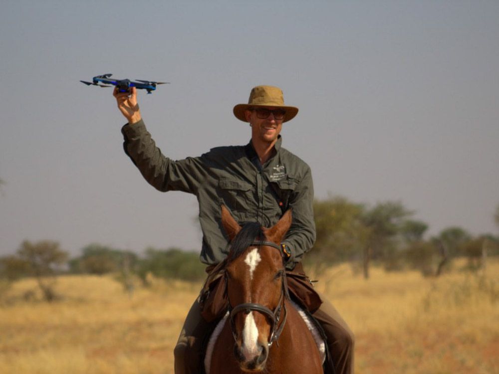
The Skydio Autonomy Engine features a number of incredible characteristics that can help enable wildlife reserves to safely and efficiently monitor their ecosystems. Having the most advanced obstacle avoidance system and an easy to pilot system, the Skydio 2 can have anyone flying within minutes. An easy and safe to fly drone opens up a new world of opportunity for wildlife conservationists to use drones.
“The Skydio 2 is a great product for people like us who are looking to integrate advanced technology to our work, but who have little experience flying drones. On my first flight, I felt immediately comfortable thanks to the obstacle avoidance system and I could fly without any fear of crashing.” — Friedrich Reinhard, General Manager at the Kuzikus Wildlife Reserve
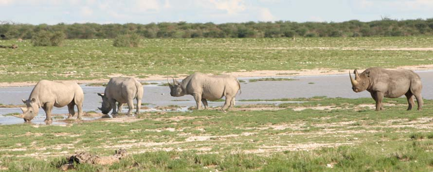
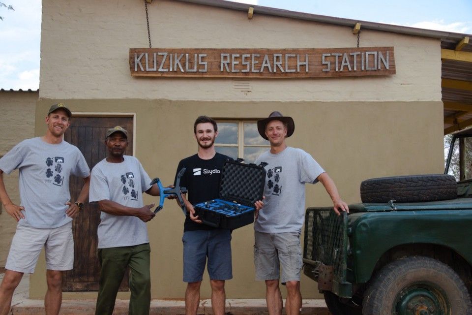
As part of an internal program at Skydio aimed to promote the positive impact of our drones, we donated a Skydio 2 to WildTrack, a non-profit focused on non-invasive wildlife monitoring. WildTrack has a longstanding research partnership with The Kuzikus Wildlife Reserve on a conservation initiative involving the critically endangered black rhino where they are working on a project to identify individual rhinos based on footprints left in the sand. Their footprint Identification Technology, FIT, can help conservationists quickly and accurately identify a nearby rhino. FIT consists of both a morphometric statistical model in JMP software and an award-winning AI platform developed in conjunction with the University of California, Berkeley.
Kuzikus Wildlife Reserve
The Kuzikus Wildlife Reserve is owned by two brothers, Berend and Friedrich, who have always been passionate about using the newest available technologies to help benefit their conservation initiative in the Namibian Black Rhino Custodianship program. Every year since 2014, they have hosted a team from Drone Adventures to come to their reserve and use an eBeeX landscape monitoring drone from senseFly to map the reserve. In previous years the teams were able to create partial maps of the reserve. This year, they succeeded in mapping the entire reserve (100 sq km) in around 10 days.
This amazing achievement by the Drone Adventures team goes to show how much improvements in battery technology and flight software have enabled teams to do more and more. Berend and Friedrich mentioned in previous years that shorter flight times and a higher likelihood of crashing actively worked against the team to stop them short of mapping the whole reserve.
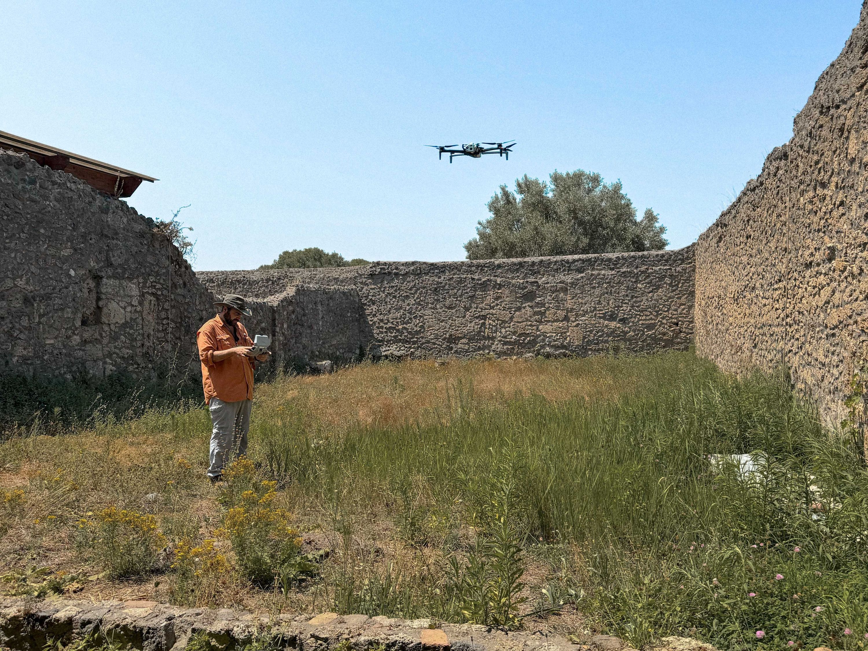
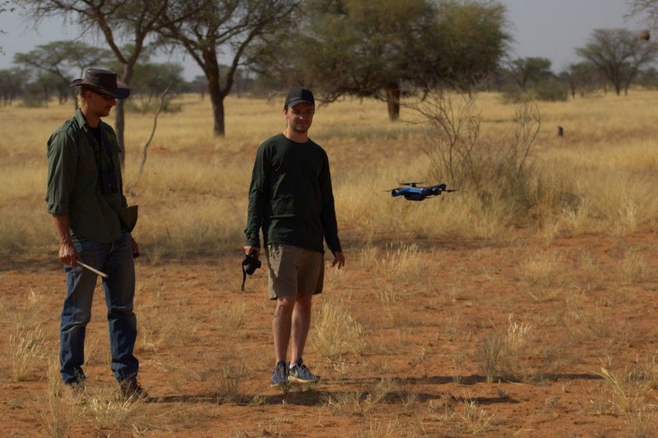
While Berend and Friedrich are quite used to the eBeeX flying around Kuzikus, this year they were joined by a Skydio 2 and myself to work on an experimental project of how our drone can help aid conservationists.
My goal was to get Berend and Friedrich feeling comfortable with the drone and familiarize them with all the features that we offer. As an Autonomy Engineer focusing on robot UX and autonomy infrastructure, I work on customer-facing features that leverage our sophisticated autonomy engine. This was the perfect opportunity to get out in the field and see what the Skydio 2 could do in the Kalahari.
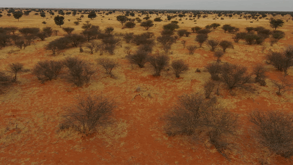
Skydio in The Kalahari Desert
The drone was donated directly to WildTrack, who decided to deploy it initially to their partners at Kuzikus for the survey they were undertaking together, so it made its debut in the Kalahari desert! Here are a few situations where we found that Skydio 2 was able to shine as a drone for wildlife conservation.
Tracking the tracker
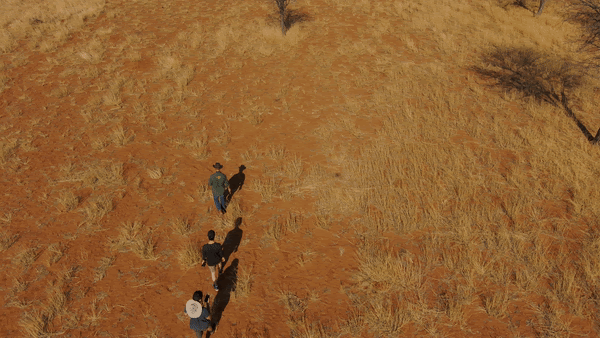
The long term goal here is to train a machine-learning algorithm to be able to recognize a rhino trail in the sand. By tracking the tracker while they follow the trail, we are able to get a great birds-eye view of what the trail looks like. Apart from gathering data, this also gives the tracker a new and useful perspective on tracking rhinos. Instead of manually piloting a drone to check for tracks, the tracker can focus on the tracking, and the drone can focus on capturing the data.
Situational awareness in Denser Brush Areas
Oftentimes when tracking a rhino, the tracks will lead into an area with thick brush. Experienced trackers will know never to track with the wind because our smell and noise gets carried with the wind, but you can never be too safe when entering a dense brush area with nearby rhinos. With the Skydio 2, the tracker could launch the drone, fly up and get a top-down view of the dense brush area to see if the rhino is there or not. 9 times out of 10 the rhino will be visible from the drone and prevent the tracker from getting into a potentially dangerous situation.
“WildTrack’s focus is on the use of non-invasive monitoring techniques to help monitor and protect endangered species. Skydio 2 can collect the high-resolution ground data we desperately need, even in the thickest bush occupied by rhino, without the risk of disturbing them. This is a huge step forward. We’re excited about deploying Skydio drones for many of our other 30 projects around the world” — Zoe Jewell, President and founder of WildTrack
Individual footprint data acquisition
With Skydio 2’s advanced image capture system, collecting images of individual footprints has never been easier. Once the rhino tracks are identified, the pilot can manually take control of the drone to take a series of photos of each print. With the addition of Skydio 3D Scan, the pilot can define a boundary where the trail is and let our drone autonomously map the area and collect the necessary data so the tracker can focus on other tasks without worrying about the drone crashing.
Safely integrating drones with wildlife
Whenever integrating new technology into natural environments, we need to be careful to do so in the most responsible way. Drones pose a potential risk to disrupting wildlife through physically harming the wildlife with crashes or introducing unnatural noise. On the technical side, all Skydio drones feature the Skydio Autonomy Engine which makes the probability of crashing lower than any other drone on the market.
On the wildlife side, Berend, Friedrich, and I developed a protocol to learn more about how to safely integrate drones into this ecosystem. The underlying strategy is to always fly downwind from the wildlife. This minimizes the level of noise reaching the animals. The actual protocol involves taking notes for each flight. In addition to the pilot, a conservationist who is experienced with rhino behavior keeps a close eye on the rhino with a pair of binoculars to take notes on the behaviors the rhino is showing.
Every 10 seconds, we note what the rhino is doing (eating, walking, running, lying down) and the approximate distance to the rhino. This data collection is all done at a minimum distance of 15–20 meters to ensure we are respecting the wildlife, not creating any disturbance to their natural behavior, and obtaining meaningful data. With enough data, we can start to classify how each rhino will react to the drone and when and how it is safe to fly.
“As part of this initiative to safely integrate drones to the Kuzikus Wildlife Reserve, we flew at a safe distance around the rhino and scored the behavior of the animal to see if the presence of the drone disturbed them. This would only be possible with drones because we had to fly at the same level as trees and bushes. We had full confidence the drone wouldn’t crash and we could fully focus on paying attention to the behavior of the rhino” — Berend Reinhard, General Manager at the Kuzikus Wildlife Reserve
All of these interesting new protocols show us that putting thought into how technology permeates into the world is important to get ahead of. The last thing we want to see is the irresponsible use of our technology negatively affecting the wildlife and nature we love. We are thrilled to have had the opportunity to work with everyone at WildTrack and the Kuzikus Wildlife Reserve to give our drone a test run in wildlife conservation work.
The future Of Skydio Drones in wildlife conservation
The future looks bright for Skydio’s ability to increase the efficiency and safety of conservationists working in the field. Working with Kuzikus opened our eyes to how Skydio’s autonomous flight can help similar organizations use drones to track wildlife. We believe wildlife conservationists can benefit from Skydio X2’s thermal cameras and night flight capabilities in their work. The powerful autonomous capabilities of Skydio drones are proving to serve a wide range of applications and we couldn’t be more excited to see what positive impact we can make in this field.
“We’ve worked with many quadcopters and they are all too easy to crash in tough field conditions. The fact that the Skydio 2 has sophisticated obstacle avoidance makes it not only safer to fly, but accessible for all members of the community team, including the expert local trackers.” — Sky Alibhai, Director and Co-founder, WildTrack
If you are interested in how Skydio and our drones can help with your wildlife tracking and conservation, please contact us.