Skydio DFR Command Makes Drone as First Responder Programs a Reality for Public Safety Agencies of All Sizes
 Skydio
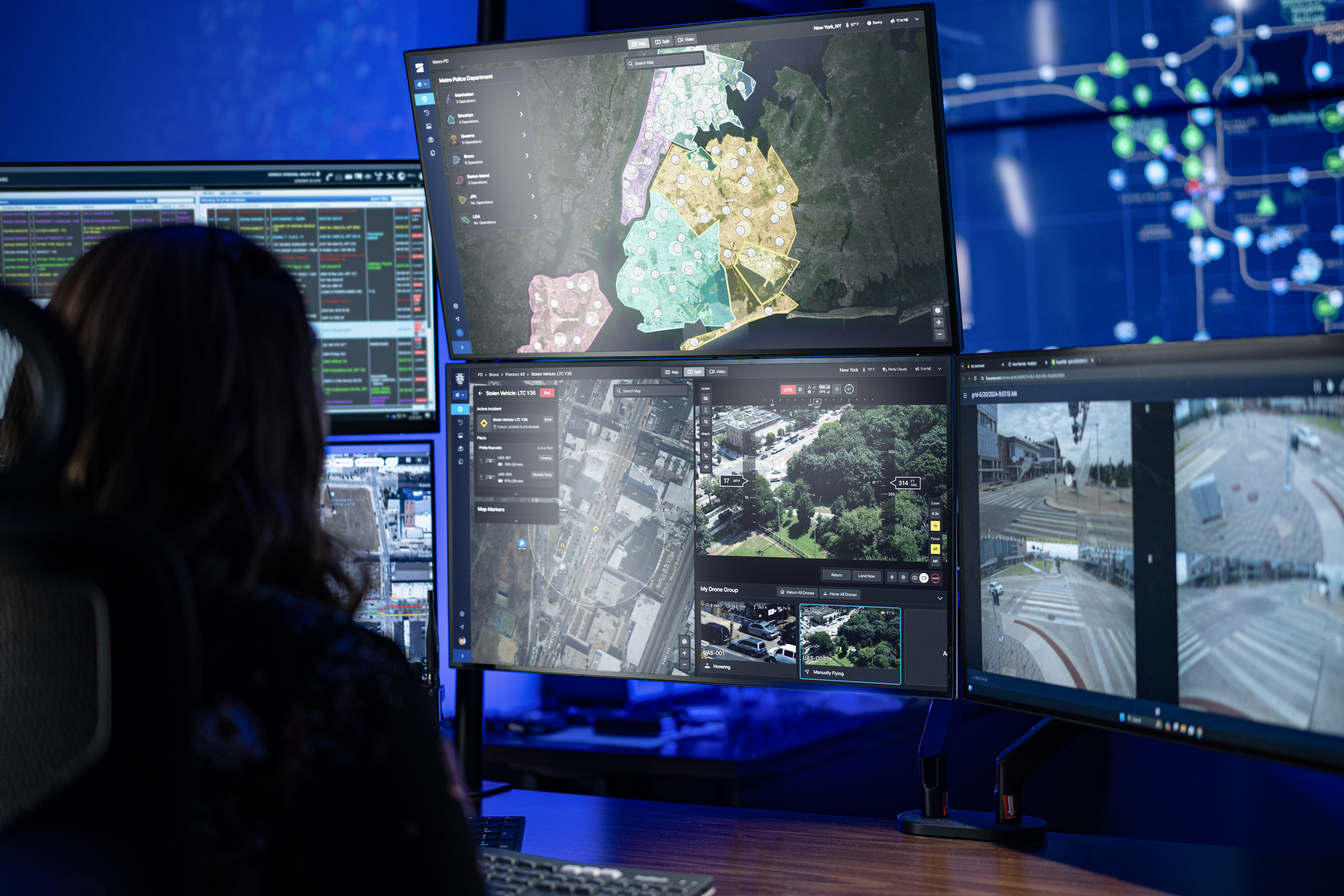
While much of the neighborhood sleeps, a security company notifies 911 of triggered alarms at a business. An officer sitting in a precinct office a few miles away receives the GPS coordinates on her screen. With one click, the drone deploys from a nearby dock 1/2 mile from the incident, autonomously flying to the scene before dispatch has even assigned ground units. Overhead a minute later, the officer finds tools on the roof. She flies low, finding a vehicle without license plates parked at the rear of the building. Flying up alongside and around the building, she looks for activity through the windows in the darkened office. While awaiting ground units, the drone takes a tactical position overhead to see all egress points, live-streaming the view to officers en route. Using thermal cameras, she sees two suspects exit the rear of the business, bags in hand, and jump into the vehicle, heading toward the roadway. As they take several turns traveling onto residential roadways, the pilot uses street overlays on the map to provide direction of travel for the ground units. Avoiding a pursuit, the officers make contact with the vehicle as it parks, and the suspects are taken into custody. Officers recover the business owner’s stolen goods. The drone returns home to the dock, and the footage is uploaded to Axon Evidence.
Drone as First Responder (DFR) programs can increase apprehension rates, keep officers and communities safer, and save valuable agency resources.
But building a DFR program is far more complex than simply buying a drone. It takes many pieces of integrated technology, closely coupled with new standard operating procedures (SOPs), and compliance with a web of regulatory and community policies to realize this transformational new response method.
Early adopters of DFR have had to contend with tremendous complexity to get even the smallest programs up and running:
- Manually assembling a Frankenstein of drones, docks, piloting software, fleet management software, and community transparency technologies - each provided by a different vendor, typically through a reseller that has limited access to the underlying engineering.
- A drone industry that doesn’t prioritize integrations. Drones must integrate seamlessly into standard systems like evidence management, computer-aided dispatch, real-time crime centers, body-worn cameras, and more as they are simply a powerful new spoke in a much larger hub of technology.
- Vendors that point to one another when something doesn’t go right.
We believe that Drone as First Responder is too important to leave success up to chance.
Introducing DFR Command
Working closely with over 500 public safety agencies over the last five years, Skydio's engineers, technologists, and former law enforcement operators have learned the best way to build a scalable drone program that makes a massive impact on the community it serves.
These learnings led us to develop Skydio DFR Command - the world's first software solution built to start, operate, and grow Drone as First Responder programs.
At its basic level, a DFR program must solve three phases: Ready, Respond, Resolve
Ready: Be Ready & Know Where to Go
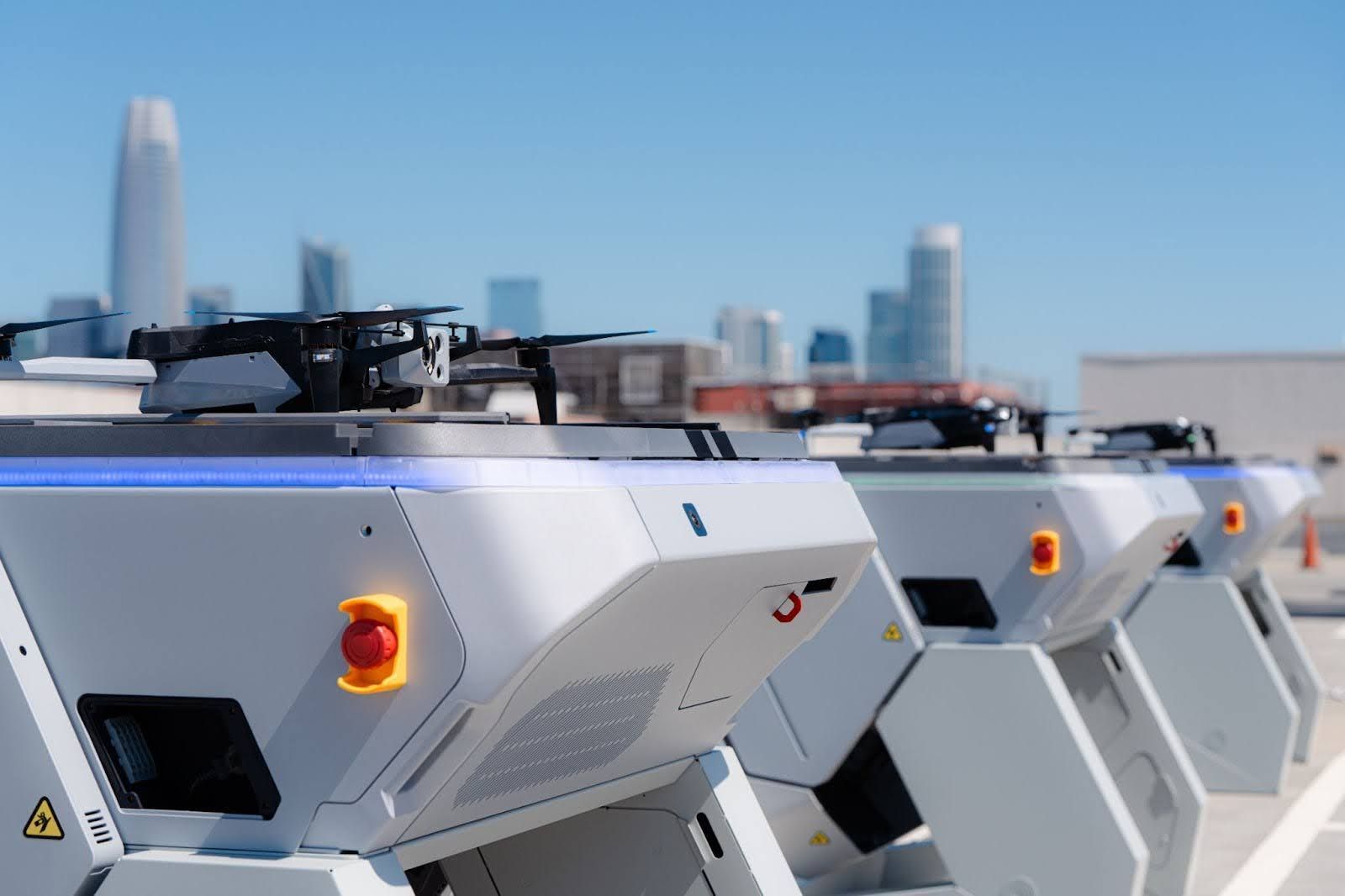
A successful program starts with positioning docked drones in the right areas and having the ability for those drones to respond quickly to calls for service. Skydio has developed a proprietary simulation algorithm to help agencies choose the best locations for their docks, setting them up to respond to over 90% of high-priority calls for service within 2 minutes. Geographic location and drone flying range are important variables to consider, but so are historical call patterns, topography, budget, community policies, and more.
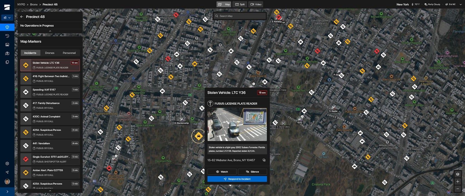
Once docked drones are in place, drone response starts with integration into the CAD, RTCC, ALPR or acoustic sensor system that can alert and provide the location of the incident. DFR Command comes pre-integrated with Fusus by Axon to receive real-time events or can be integrated with your specific systems. Considering topography, environment, potential obstacles and geofences, Skydio Pathfinder, chooses the best flight path to reach the incident’s GPS coordinates. With integration into Dedrone, or your choice of airspace awareness system, DFR Command will display other airborne traffic for deconfliction.
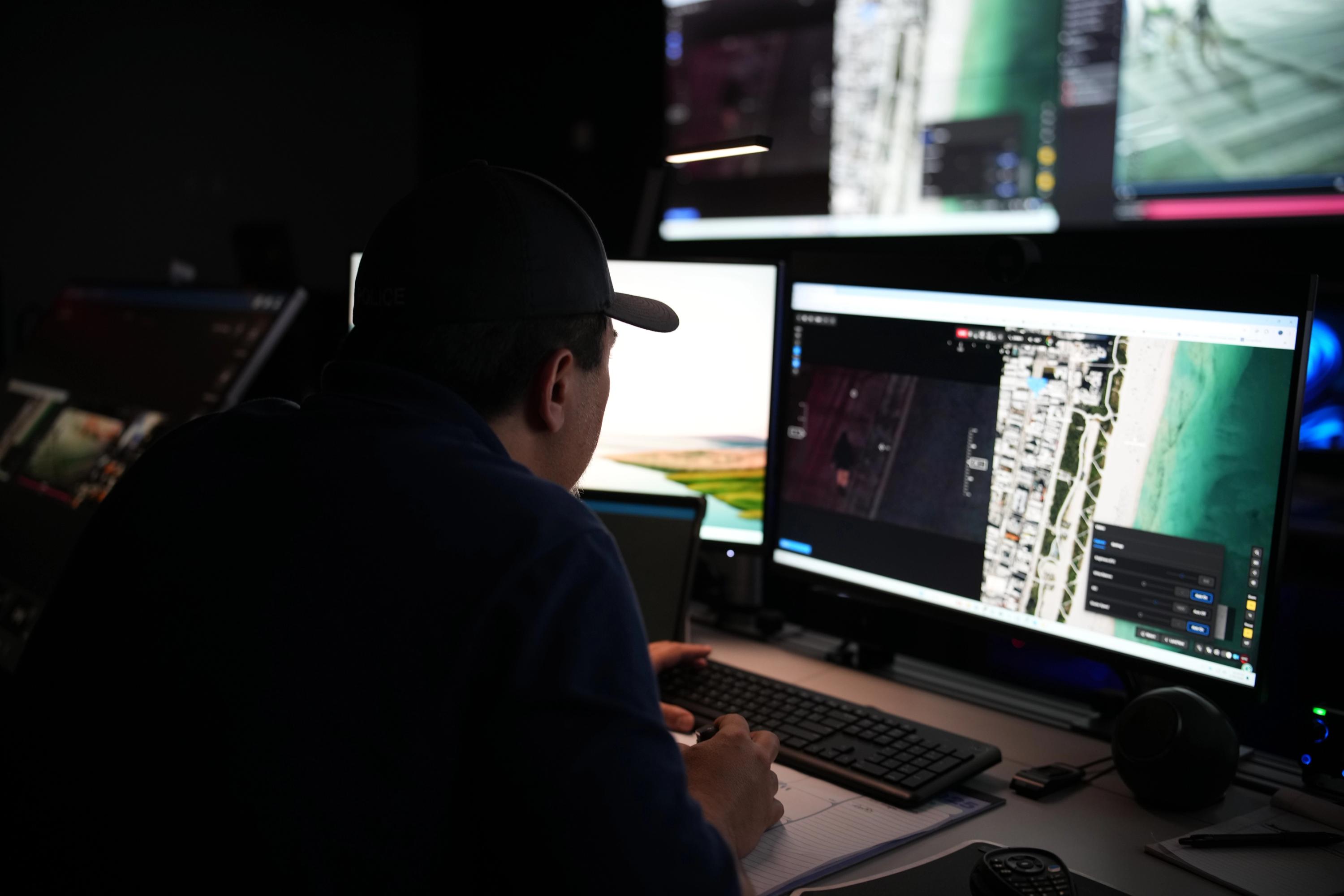
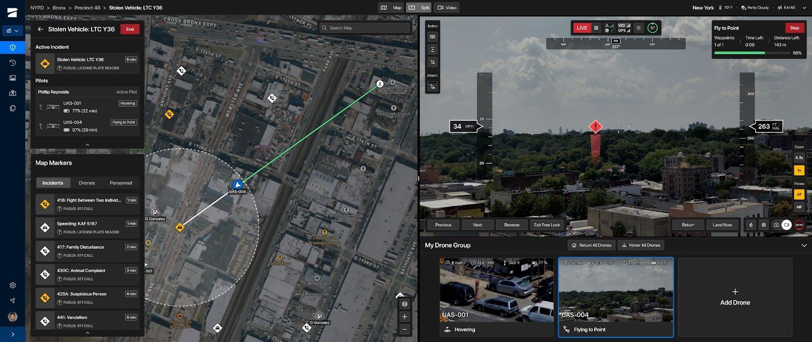
Respond: Get Eyes on Scene Fast and Safe, and Inform All Who Need to Know
It’s now time to respond to the incident and gain situational awareness. DFR Command provides the capabilities to get on scene quickly and safely while providing live streaming to responding officers and stakeholders:
- With pre-positioned Docks for X10 and automated incident triggers from a CAD, RTCC, ALPR or acoustic sensor, drones can be airborne in 20 seconds with a single click.
- Officers can request drone overwatch by simply pushing a button on the Axon body-worn camera.
- In addition, drones in patrol cars can be hand-activated onsite by an officer, with flight controls handed off to an operator in a remote center. The onsite officer can now get backup support while maintaining situational awareness to what is in front of them.
- With Skydio Autonomy, flight routes are automatically suggested to account for terrain, geofences, airspace limitation and more.
- A single drone pilot can operate multiple drones simultaneously, achieving unprecedented, continuous aerial coverage for every mission.
- Augmented reality (AR) overlays for street names, house numbers and points of interest make situational awareness easy, helping all stakeholders quickly orient themselves to every situation.
- Most importantly, responding officers receive a common operating picture, live streamed to any phone or browser. Drone views can be automatically streamed to Fusus by Axon, Axon Respond, or your choice of RTCC system.
Augmented reality (AR) overlays for street names, house numbers and points of interest help operators orient themselves quickly.
With onboard AI by Skydio Autonomy, drones avoid obstacles and enable operators to fly up, down, sideways, and backward while operators keep their focus on the incident, not on steering the aircraft. Skydio X10 can also fly low and close to objects—being able to search for suspects by seeing clearly through windows into vehicles and buildings day and night.
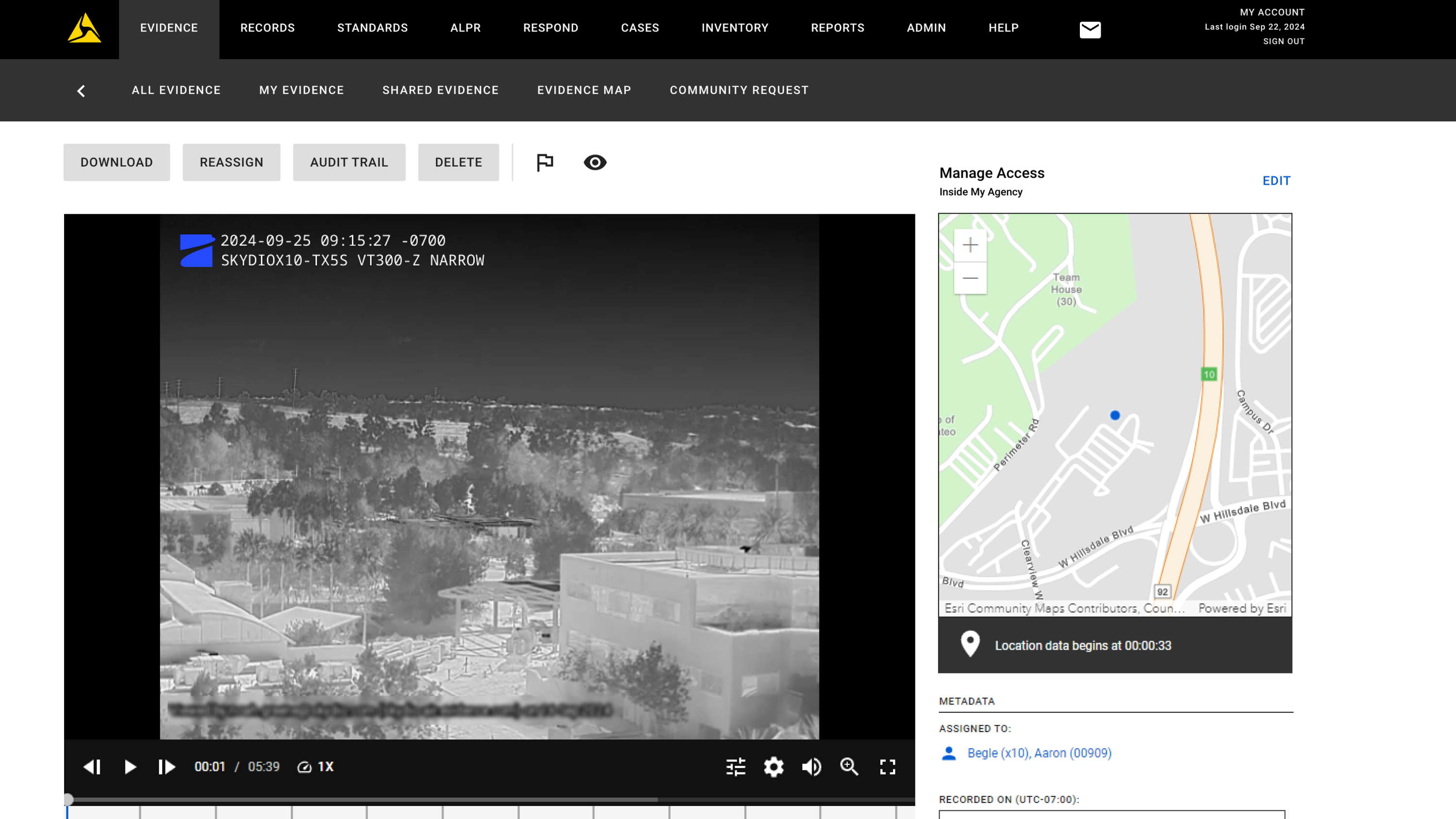
Resolve: Comply with Evidence and Community Policies
Drone-captured media may be required as evidence and should be treated with care. An industry-first, Skydio X10 now comes with recorded media watermarks. Critical information including date, time, X10 serial number, sensor package and the specific camera used for that capture moment will be notated in the upper left corner of video and photo files. This data allows for second-by-second synchronization with body camera footage, providing an even more comprehensive, objective source of truth of an incident from many different vantage points.
With media now marked for evidentiary use, DFR Command automatically uploads files to Axon Evidence and other digital evidence management systems upon flight completion.
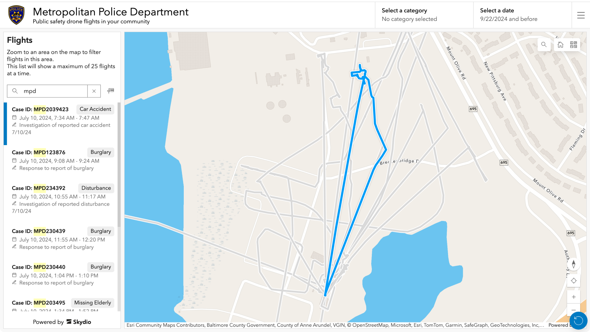
DFR Command enables first responders to continually build community trust through transparency. With the new Transparency Dashboard, agencies can, at their discretion, provide their communities with flight details such as date, start/stop time, telemetry, reason for flight and case number. This is instrumental in helping community stakeholders gain trust in the program and alleviate fears of technology misuse.
Grow your drone operations into critical capabilities for your community.
As technology continues to advance, so will your DFR program. Putting together a DFR program requires skills that your agency may or may not already have, and may not have an ongoing need for. Skydio is here to help you with the core aspects of starting your DFR program, including regulatory, advisory, and deployment services.
This set of services has proven effective in standing up some of the world’s leading DFR programs, and we are excited to bring them to your community in concert with our technology offerings.
DFR Command is a giant leap forward in our mission to deliver the most complete and capable DFR solution to emergency responders. It incorporates feedback and experience from customers who are blazing the DFR trail daily, every day, from small suburban environments to expansive metropolitan cities. When combined with Skydio's deep partnership with Axon, DFR Command and Skydio offer the most comprehensive and vertically integrated DFR solution. We know DFR is a game changer, and we can't wait to see how our customers use autonomous drones to deliver safer communities everywhere.
Get Started Today
Contact us to learn how you can get started with your agency’s drone program. If you think DFR could be useful for your community, Skydio can get a low-friction trial up and running in a matter of weeks to start showing value to your command staff, city councils, mayors and more.