UTILITIES: DISTRIBUTION NETWORK INSPECTION DRONES
Minimize risks while maximizing asset longevity with aerial inspections
See how a drone program can dramatically improve your safety and long-term maintenance objectives
Respond to outages and conduct planned inspections 3x faster
Get high-resolution cameras within arms-length of electrical equipment with much less danger and effort than with bucket truck crews. Just a few hours of training can get inspectors flying with Skydio.
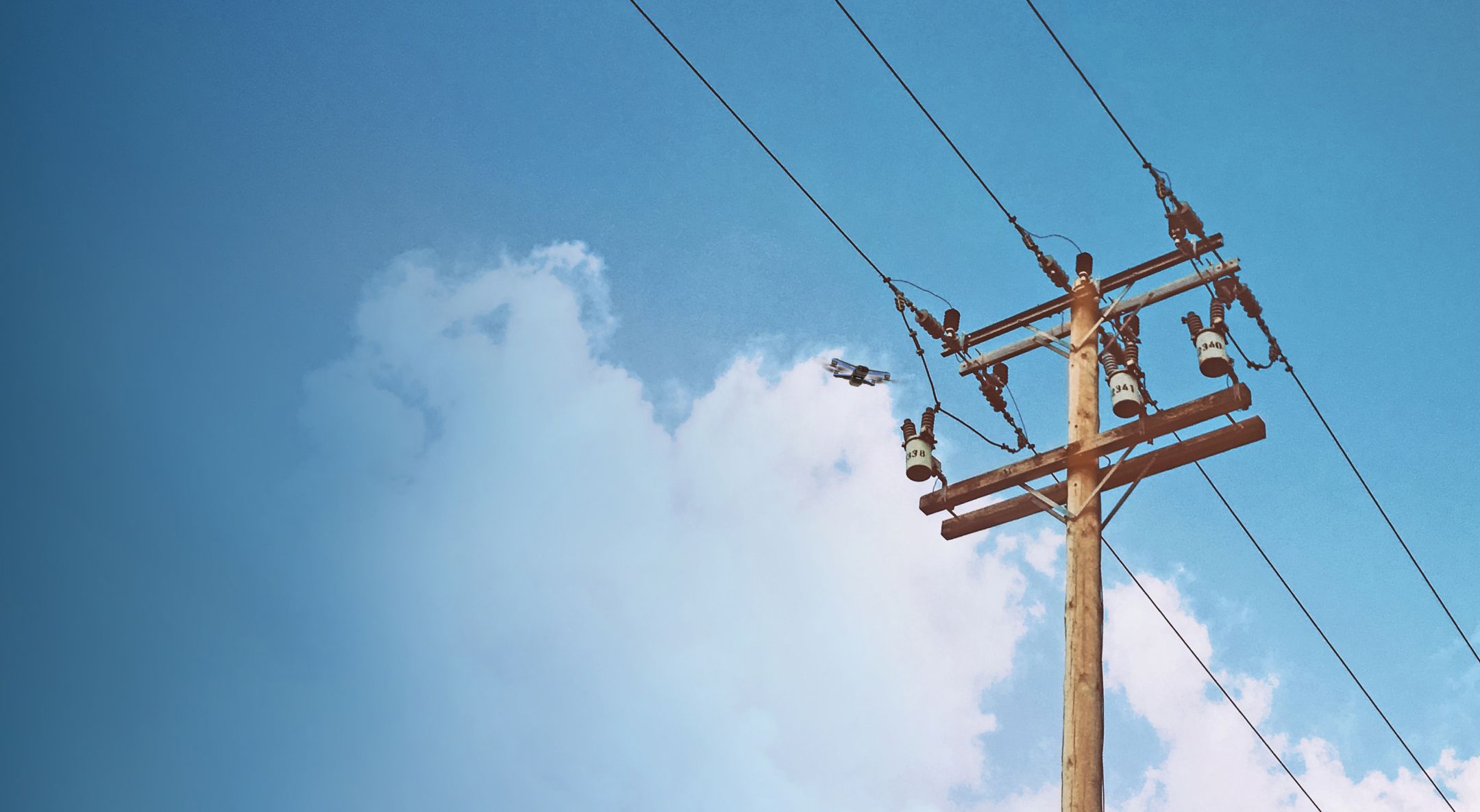
Our ground-breaking AI-driven navigation system makes it easy to avoid obstacles as you fly, even in high EMI environments, as our drones don't rely on GPS. You'll capture better quality data from any insulator, transformer, or line far faster than manual crews.

No other drone utility inspection solution performs like Skydio
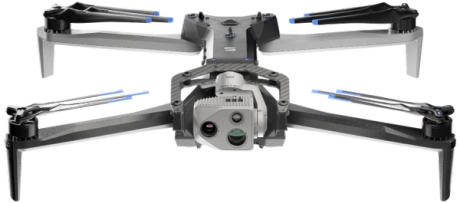
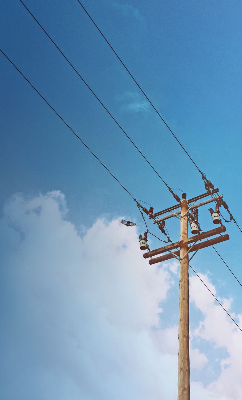
Capture images and video of any part of the distribution network
Locate breaks and identify maintenance needs faster with aerial inspections powered by Skydio. No need to call in specialists, assign inspectors to dangerous situations, or mobilize cumbersome bucket truck crews. Now, you can swiftly maneuver into highly energized, obstacle-rich environments to get the shots you need and limit service interruptions.

Get airborne without a heavy training burden
Proficient in a few minutes and expert in just hours, your existing crew can capture the data they need without hiring additional pilots. Our market-leading autonomous technology makes it easy to navigate around obstacles without crashing. Any operator, no matter their skill level, can confidently fly power line inspections in complex environments, avoiding trees, lines, and poles.

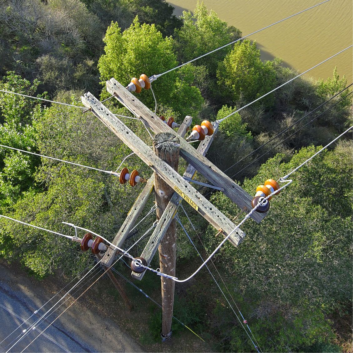
Collect the highest quality inspection data, everytime
Gather high-precision data on substations and utility poles to diagnose and plan repairs faster. Reposition quickly to capture every angle on your shot list. Skydio’s navigation system – unlike traditional drones’ – is unaffected by electromagnetic interference (EMI), so you can maneuver through charged lines without a hitch.
Three more reasons utility professionals love Skydio
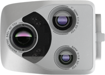
Thermal Equipped
Identify heat and temperature differences to recognize anomalies on critical power generation infrastructure.

Trusted Source
Protect the security of critical infrastructure with a solution designed, assembled, and supported in the USA.

Regulatory Guidance
Engage our team of experts to help you through the BVLOS waiver process.
Top utilities trust Skydio to monitor critical infrastructure